
Newfoundland
& Labrador Pilots
Contact
Capt. Jason Wicks
There are currently 14 full-time pilots responsible for the safe navigation of vessels in the major compulsory pilotage areas of Placentia Bay, St. John’s, and Holyrood; and 3 full-time pilots for the minor compulsory areas of Humber Arm, Bay of Exploits, and Stephenville. Voisey’s Bay, on the coast of Labrador, is also designated as a compulsory area.
Pilots for the major ports must meet or exceed the minimum requirement of Master, Near Coastal. They are highly skilled master mariners with over 20 years of combined nautical training and sea experience. Most pilots for the minor ports hold a Master, Near Coastal or higher, which exceeds the minimum requirement for a 500 tonne Master Certificate. Critical success factors: Local knowledge of waterways and targeted specialized training throughout career.
Designation as a compulsory pilotage area depends on local levels of risk to safe navigation and takes into account a number of criteria including:
- Degree of difficulty and hazard in the approaches and within the port itself;
- Amount of vessel movement and maneuverability and the size of those vessels;
- Design of wharfs, slips, and actual space available for maneuvering;
- Nature of cargo carried on board (e.g. oil, gas, explosives, hazardous materials); and
- Environmental concerns and the preservation of the ecosystem.

Placentia Bay
Placentia Bay lies on Newfoundland’s southeast coast dividing the Avalon and Burin Peninsulas. It is an exceptionally deep natural port with depths of 240 metres at midpoint. It is roughly 145km wide at its entrance and 125km long, with exposure to southwesterly winds and currents. Shorelines are dominated by coarse-grained gravel deposits and cliffs. Placentia Bay has 26 incorporated and 30 unincorporated communities, and another I0 smaller settlements. Major ports include Come By Chance, Whiffen Head, Long Harbour, Argentia and Marystown.
Navigational Challenges
Long and Red Islands divide the fairway into three channels. Eastern Channel is the main shipping channel and accommodates two-way traffic in a “recommended traffic route”. This route is not IMO-adopted and -approved and therefore does not require the separation of fishing activities from commercial shipping lanes. The Bay is home to numerous active fisheries and it is common for fishing gear to be in the “recommended traffic route” which creates uncertainty with respect to traffic density especially during peak fishing seasons. Other navigational challenges include handling large ships in borderline wind conditions, night navigation of tankers, and fog - visibility is reduced to less than half a nautical mile for more than 187 days a year. In heavy ice years, there can be a considerable amount of ice and small icebergs driven into the Bay by south and SW winds.
Traffic: Largest Energy Hub Port in Canada
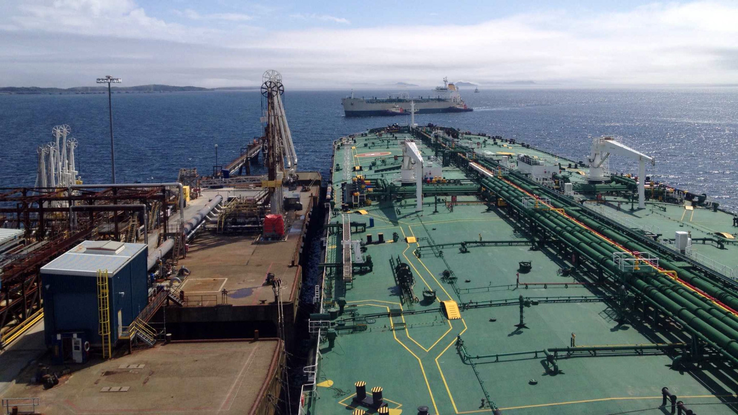
Newfoundland and Labrador’s offshore oil and gas industry is based in Placentia Bay making it the largest energy hub port in Canada. It is home to Newfoundland Transshipment Limited (NTL) and the North Atlantic Oil Refinery (NAR). Placentia Bay pilots are skilled in ship handling tankers of all sizes which enables customers to tailor the size of ship to the buyer’s needs from small coastal tankers up to and including very large and ultra large crude carriers (VLCC and ULCC) which carry in excess of 2 million barrels of crude. The main types of traffic are tankers, general cargo ships and small fishing craft. Marine Atlantic operates the Argentia – North Sydney, NS ferry route up to three times per week from mid-June to late September. Here is a link to the typical Master-Pilot Exchange for Placentia Bay.
Pilots’ Particular Areas of Expertise: Handling the Largest Ships in the World Fleet
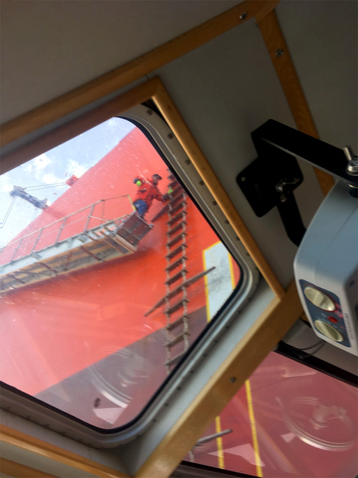
The largest ships in the world fleet call at Placentia Bay with the pilots responsible for the safe navigation, safety of personnel, and protection of the environment 24/7 year-round. Conducting the navigation and berthing requires great precision and skill with constant vigilance of weather conditions – strong prevailing winds at the pilot boarding station, and very changeable winds during the transit – and expertise in the direction of tugs to escort and berth the ships. Bay pilots are skilled at night navigation, ice navigation, and navigating in reduced visibility.
Marine domain awareness is key for the successful coexistence of diametrically opposed industries in confined waterways. Pilots are recruited from Newfoundland and maintain close connections with the fishers. Pilots carry aboard portable pilotage units (PPU) with the most up to date information and charting and use SmartAtlantic inshore weather buoys in the Bay for forecasting of met/ocean conditions to determine safe operating windows for vessel transits and moves. Pilots are active members of the Placentia Bay Traffic Committee.


St. John’s
St. John’s Harbour is entered between South Head and North Head, about 305m (1,000 ft) apart. The Narrows, with a least depth of 11.8m (39 ft) on the leading lights, leads for about 0.5 mile into the harbour. The channel is 92m (302 ft) wide in the vicinity of Chain Rock. Vestal Rock, with a depth of 3.7m (12 ft), lies 65m (213 ft) SE of the headland of South Head. Signal Hill rises to an elevation of 152m (499 ft), 0.3 mile NNW of North Head. Cabot Tower, conspicuous from seaward, stands on Signal Hill; it was at this tower that Marconi heard the first radio signal across the Atlantic in 1901.
Navigational Challenges
The narrow entrance between sheer cliffs coupled with an uneven bottom resulting in various depths, severely restricts vessel maneuverability in the approaches. In early spring, easterly winds prevail, driving heavy field ice on to the coast, and at times icebergs drift into The Narrows. During extended periods of strong east, SE and NE winds, ocean swells have been reported to enter St. John’s Harbour causing surging alongside its berths. The wave energy is reported to be reflected within the harbour and has been reported to be especially pronounced along the north side and the west end. Berthing accommodations are located around most the inner harbour.
Traffic
St. John’s is the home to St. John’s Port Authority as well as numerous private terminals catering to offshore supply vessels, vessel maintenance and repair, marine fueling and lubricants, and the Canadian Coast Guard Base. It is considered to be the principal gateway port for Newfoundland’s containerized and general cargo, and the commercial and technical centre for the Province’s offshore oil and gas industry. Vessel traffic consists of offshore supply vessels, bulk carriers, product size tankers i.e. the Acadian/East Coast (Length 183m X Breadth 27.4m, GRT 23,519, DWT 37515 t.), and drill ships. Oceanex’s Connaigra ro/ro vessel (roll on/roll off) with capacity for 1300 TEU is the largest containership using St. John’s as a regular caller (Length 210m X Breadth 29.6m, GRT 26,786, DWT 19460 t). St. John’s is also an important cruise ship destination. Here is a link to the typical Master-Pilot Exchange for St. John’s.
Pilots’ Particular Areas of Expertise
Pilots are responsible for the safe navigation, safety of personnel, and protection of the environment 24/7 year-round in a very confined and active waterway. Conducting the navigation and berthing requires great precision and skill with constant vigilance of an active marine domain. Pilots are experts in knowing how different vessels will respond in various weather and sea state conditions and bringing them alongside with little to no tug resources. St. John’s pilots are highly skilled in night navigation, ice navigation, and navigating in reduced visibility.
Pilots carry aboard portable pilotage units (PPU) with the most up to date information and charting and use SmartAtlantic inshore weather buoys for forecasting of met/ocean conditions to determine safe operating windows for vessel transits. Pilots actively support economic development opportunities for the region through specialized training and simulation i.e. to develop safe operating parameters for larger cruise ships.
