
Cape Breton Pilots
Contact
Capt. Scott MacDonald
There are four compulsory pilotage ports/areas in the Province of Nova Scotia: three are in Cape Breton – Canso, Sydney and the Bras D’or Lakes; and one on the mainland – Halifax. There are currently 9 licensed full-time pilots serving the major ports/pilotage areas of Cape Breton, a staffing level that is established by the federal government in consultation with pilots and industry, and which reflects actual and anticipated traffic levels.
Pilots for the major ports must meet or exceed the minimum requirement of Master, Near Coastal. They are highly skilled master mariners with many years of sea experience and extensive nautical training. Critical success factors: Local knowledge of waterways and targeted specialized training throughout career.
Pilots usually board the vessel by means of the ship’s rope pilot ladder, either alone or in combination with an accommodation ladder, often climbing the side of the vessel for up to 9 m. Embarking and disembarking pilots is always risky, and even more so during night navigation and under inclement conditions. Once the pilot is aboard, they go to the vessel's bridge area where they have conduct of the vessel until it has safely transited pilotage waters or is safely secured to the berth.
Cape Breton pilots support economic development and safe shipping through their contribution of nautical technical expertise to government and/or private sector entities’ projects (i.e., Termpol studies for the Goldboro LNG and the Bear Head LNG projects), modifications to existing port infrastructure (i.e. deepening the channel for Sydney Harbour), and other projects (i.e. OPP Met/Port Demonstration Project for Chedabucto Bay). One Cape Breton pilot sits on the Strait Superport Corporation Board of Directors which is comprised of volunteers who represent diverse interests in the Strait of Canso region.

Designation as a compulsory pilotage area depends on local levels of risk to safe navigation and takes into account a number of criteria including:
- Degree of difficulty and hazard in the approaches and within the port itself;
- Amount of vessel movement and maneuverability and the size of those vessels;
- Design of wharfs, slips, and actual space available for maneuvering;
- Nature of cargo carried on board (e.g. oil, gas, explosives, hazardous materials); and
- Environmental concerns and the preservation of the ecosystem.

Canso
It is hard to imagine a more ideal deep-draft port than the Strait of Canso. Physically separating Cape Breton Island and mainland Nova Scotia, it offers commercial shipping access from both the Gulf of St. Lawrence (via the Canso Canal), and directly from the North Atlantic (via Chedabucto Bay).
Canso is one of Canada’s leading energy hub ports. Its proximity to international and domestic shipping routes combined with very deep water make it ideal for handling import and export crude oil and petroleum products. The geology of the area around the Strait is rich in aggregates and timber lands which are other key exports. Deep draft ships are able to berth and load to full capacity safely which allows for greater economies of scale for port customers.
The Strait of Canso and Chedabucto Bay are ice-free. For vessels entering or leaving Chedabucto Bay, a compulsory traffic separation scheme is in effect. The controlling draft in the traffic lanes is 28 m. The Strait is 27 NM between the North and South Pilot Stations with a limiting draft of 24 m. It is bordered by the communities of Inverness County, Richmond County, Guysborough County, Port Hawkesbury, Port Hastings and Mulgrave.
Canso Causeway and the Canso (swing) Bridge form the only permanent link between mainland Nova Scotia and Cape Breton Island. The Causeway extends 1.4 km across water and is 66 m deep at its deepest point. Canso (swing) Bridge is 94 m in length and provides the opening in the Causeway for Seawaymax vessels to transit the lock. The Canadian Coast Guard, which operates the Canal, credits sailing through the Strait of Canso saves time and fuel costs by trimming 70 nautical miles off the voyage to Montreal and 171 nautical miles off a trip to Charlottetown versus sailing around the tip of Cape Breton. Click here for more information on Canso Canal Operations, and here is a link to the typical Master-Pilot Exchange for Canso.

Navigational Challenges
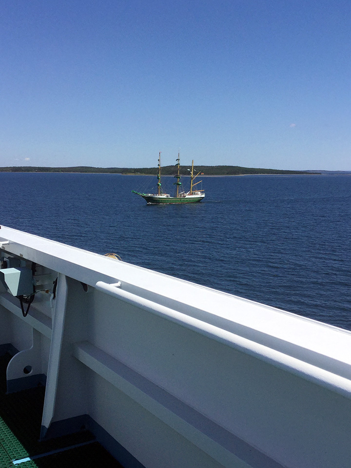
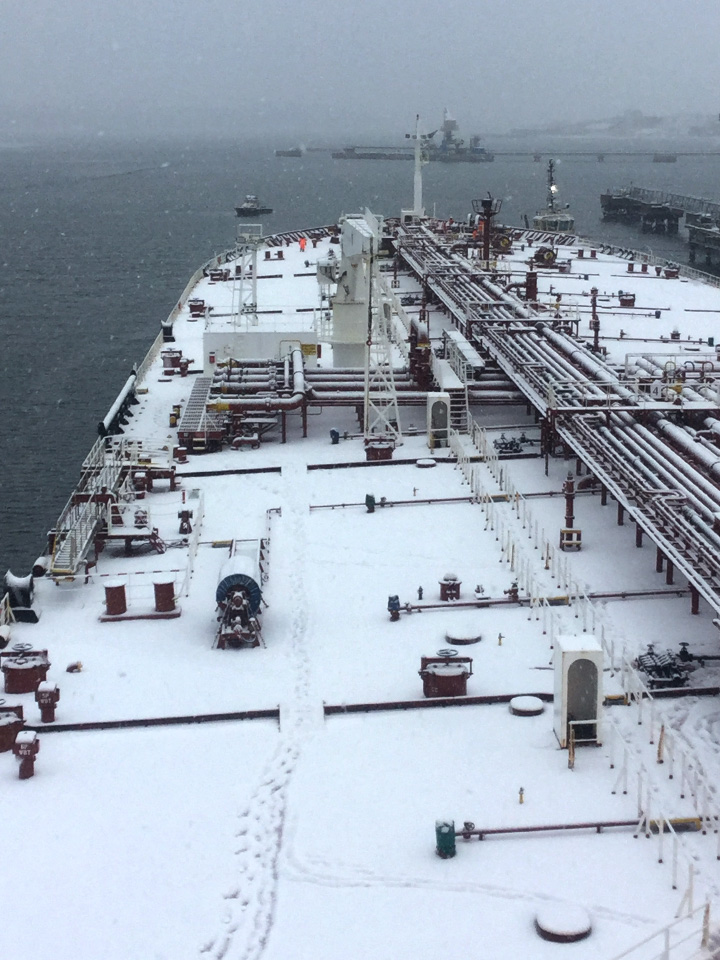
Cape Breton pilots are expert ship handlers in a broad range of vessels that vary widely in terms of scale, maneuverability and cargoes, i.e. oil tankers up to VLCC and ULCC, bulk carriers up to Cape Size, self-unloaders, tug and barge operations, general cargo ships, cruise ships (Sydney) and private yachts. We also handle project vessels such as Semi-submersible oil rigs and the heavy lift submersible ships. Within the Cape Breton Pilotage District, there are 18 docks, 9 designated anchorages in the Canso Strait, 2 anchorages in Sydney, the Port of Sydney, Chedabucto Bay, Canso Strait, Canso Canal, St. Peter’s Canal and the Seal Island Bridge.
For ship traffic arriving from the North Atlantic, the entrance to Chedabucto Bay is approximately 9 NM wide between Green Island and Cape Canso. When boarding or disembarking ships on the western side of the Atlantic Ocean, Cape Breton pilots must sometimes deal with very rough sea and swell conditions.
The main traffic corridor through the Bay leads into the Strait of Canso, past numerous islands, inlets and rocks. Many of these rocks are awash with the sea breaking over them. The wreck of the oil tanker M.V. Arrow lies close to Cerebus Rock as a sober reminder of why safety must be the number one priority in moving hazardous cargoes. It is common for fishing craft and gear to be in the approaches to Chedabucto Bay and the Bay itself.
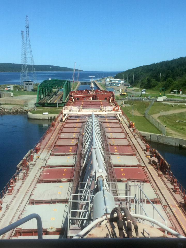
For ships arriving from the Gulf of St. Lawrence, the entrance to Canso Canal is adjacent to the Canso Causeway. In order for ships to transit from the Gulf to the Strait, the Canso Canal (swing) Bridge is opened which temporarily disconnects a section of the Trans-Canada Highway and rail line that connect mainland Nova Scotia to Cape Breton. The Canso lock is 250 m long with a minimum depth of 9.1 m. It is an important trade route especially during the navigation season in the St. Lawrence Seaway.
Canso Lock must be entered with no guide walls when entering from the south, and sometimes tug assistance must be used. Any vessel that can transit the St. Lawrence Seaway can use the Canso Canal (“Seawaymax”). Seawaymax refers to the maximum size of ship that can fit through the canal locks of the St. Lawrence Seaway. The Canso Causeway and Canso Bridge are critical infrastructure for the movement of people and goods. Cape Breton pilots bear an immense responsibility as an incident could cut-off road and rail access between Cape Breton and the rest of Nova Scotia in addition to disrupting shipping to Central Canada via the Canal.
On December 5, 2003, the International Maritime Organization (IMO) adopted Guidelines on Places of Refuge for Ships in Need of Assistance (resolution A.949(23)). Canso is a port of refuge so pilots may be required to board and have the conduct of damaged vessels or vessels with mechanical or other issues on board.
Traffic
Many people are unaware that in terms of throughput (volume of cargo handled annually over port facilities), Canso is a major Canadian port for bulk products – crude oil, petroleum products, construction aggregates, paper products, coal and road salt. According to the Strait Superport Corporation, Canso handles roughly 61% of Nova Scotia’s international and domestic cargo tonnage.
NuStar Energy’s transshipment and storage facility handles crude oil and petroleum products. It is able to accommodate oil tankers up to 350,000 DWT. Product is loaded for export onto smaller oil tankers for redistribution within Atlantic Canada or ports along the US East Coast. Bulk carriers delivering coal to Nova Scotia’s Point Tupper Generating Station range in size up Panamax with 75,000 DWT although the berth can accommodate larger ships with drafts up to 17 m.
The Porcupine Mountain Quarry operated by Martin Marietta Materials Canada is one of Canada’s largest producers of construction aggregates and one of the largest tidewater stone quarries in North America. Vessels currently range in size up to Panamax bulk carriers of 75,000 DWT. Port Hawkesbury Paper handles primarily 35,000 DWT breakbulk carriers. Mulgrave Marine Terminals primarily handles general cargo vessels. Other marine traffic includes small fishing craft, and tug and barge. There are numerous yacht clubs throughout the area.

Sydney
Sydney Harbour is located on the East coast of Cape Breton Island and is accessed from the North Atlantic via the Cabot Strait between Cranberry Point and Low Point. The Harbour is a “Y-shaped” inlet running SW about 5 NM to Port Edward, where it divides into the North West Arm and the South Arm. The pilot boarding station is in the Cabot Strait, 4.5 NM north of Low Point Lighthouse.
From its base in the North West Arm, Marine Atlantic operates a year-round commercial ferry service between North Sydney and Newfoundland. The main port facilities for commercial shipping are located in the South Arm. These include the International Coal Pier, Atlantic Canada Bulk Terminal, Sydport, and the Sydney Marine Terminal/Joan Harriss Cruise Pavilion. Sydney Harbour is 16 km in length from Cranberry Point to the southernmost point of the South Arm. The controlling draft is the main shipping channel is 11.58 m.
Sydney is the largest urban area on Cape Breton Island. The port has good access for ships on international trade routes via the North Atlantic, or trade routes via the Great Lakes / Saint Lawrence Seaway and Atlantic Canada. Here is a link to the typical Master-Pilot Exchange for Sydney.

Navigational Challenges
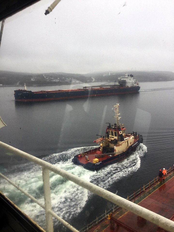
One of the main navigational challenges is the lack of support services for port operations. There are no met/hydro sensors or high resolution forecasting of weather and sea state which pilots have in the other major compulsory pilotage ports in Atlantic Canada. Being able to forecast safe operating windows for vessel transits and movements increases safety but also improves port efficiency. It would be particularly valuable in Sydney for handling cruise ships which have large windage areas, rely on tendering, and sometimes the ships extend beyond the length of the berths. There is no dedicated tug service for Sydney. There may be tugs laying up in port and, if the timing is right, sometimes the pilots may utilize tug service.
Other challenges to navigation include: (1) Sydney Harbour is totally exposed from the NE. During and after storm systems that produce NE winds, the sea conditions in the Harbour are quite rough; (2) It is open year-round and in the spring ice-breaker support may be required; and (3) In 2012, federal, provincial and municipal funding was invested to dredge the channel to 16 m. The Canadian Coast Guard is developing a new aids to navigation plan. The existing navaids are for the channel prior to dredging and do not line up with the new one.
Traffic
The main types of traffic in the Sydney Pilotage Area is commercial shipping traffic operating from port facilities in the Port of Sydney. Commercial ship traffic is comprised primarily of cruise ships, break bulk and bulk carriers, oil tankers, and project cargo. The Port of Sydney is situated within a designated Canadian Foreign Trade Zone. Marine Atlantic ferries (which do not require pilots) also operate from North Sydney.
Sydney is a thriving cruise port of call from late April through to the end of October when it is common to see multiple cruise vessels in port on the same day. There is a very broad customer base representing the major cruise lines from smaller niche operators to the large mass-market brands. One hundred and nineteen cruise calls were scheduled for 2020 before the season was cancelled as a result of COVID-19. There are 2 cruise berths, the Joan Harriss Cruise Pavilion as well as tendering options.
The port has traditionally been a bulk / break bulk port for commodities including coal, aggregates, forest products and petroleum products. In more recent years, the Port of Sydney has invested resources in its NOVAPORTE project to construct a new multimodal terminal that is purpose built to handle Ultra Large Container Vessels (ULCV) of greater than 18,000 TEU.
Pilots’ Particular Areas of Expertise
The skills required by today’s pilots are ever increasing. Advances in technology have not diminished their role. The presence of a pilot onboard, a specialist from the local community, is to preserve public and environmental safety, and to promote port efficiency. Conducting the safe navigation and berthing of massive vessels requires great precision and skill with constant vigilance of weather and sea-state on vessel dynamics, air gap (Seal Island Bridge), windage, currents, tides and other traffic in the waterway. Cape Breton pilots are experts in ice navigation, night navigation, navigating in reduced visibility, and in the direction of tugs for escorting and berthing operations.
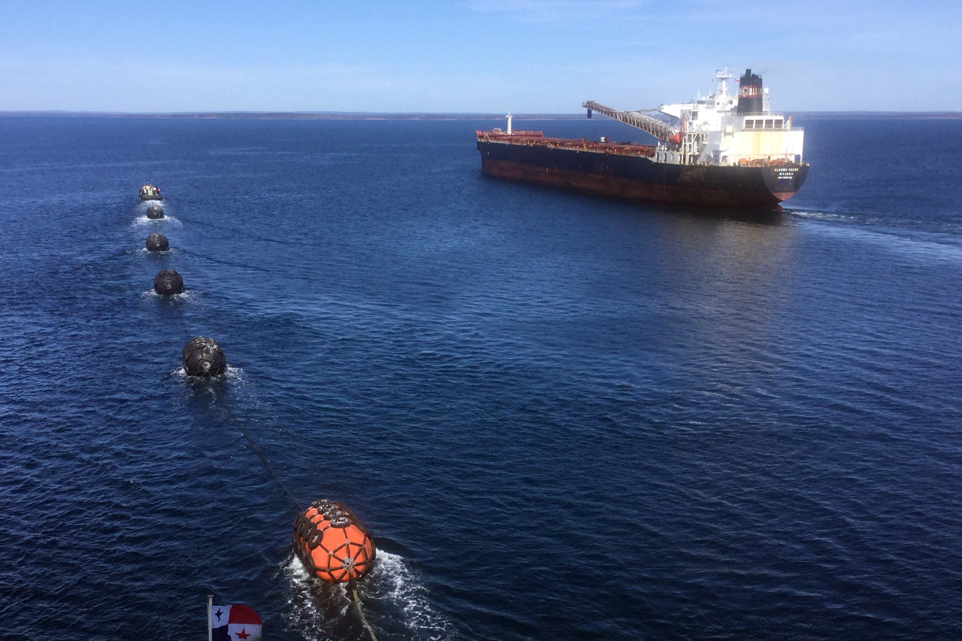
Cape Breton pilots embrace new technology where it improves safety. They carry aboard portable pilotage units (PPU) with the most up to date information and charting. Cape Breton pilots are pleased to be working collaboratively with Transport Canada, Environment and Climate Change Canada, and other stakeholders on the Ocean Protection Plan Met/Port Demonstration Project which uses two smart buoys in Chedabucto Bay for forecasting of met/ocean conditions to determine safe operating windows for vessel transits and moves.